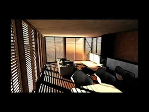

Diploma thesis – Loukas Fatouros. Technical University of Crete, School of Architecture
pARk: Augmented Reality for Participatory Urban Planning in the Gerovouno District of Kamatero, Athens
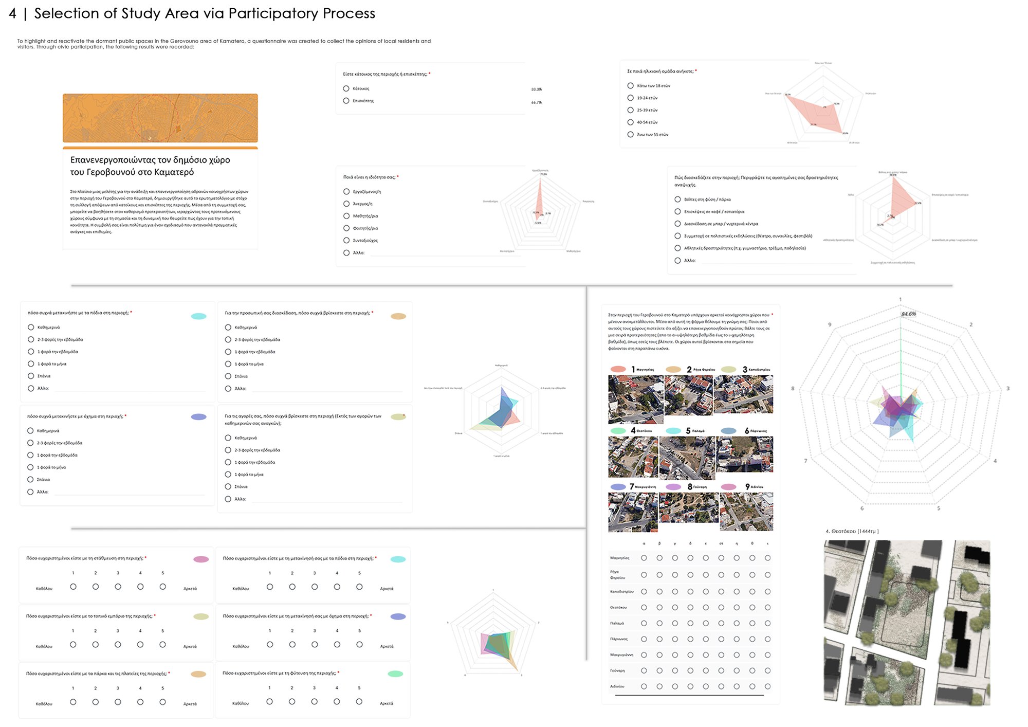
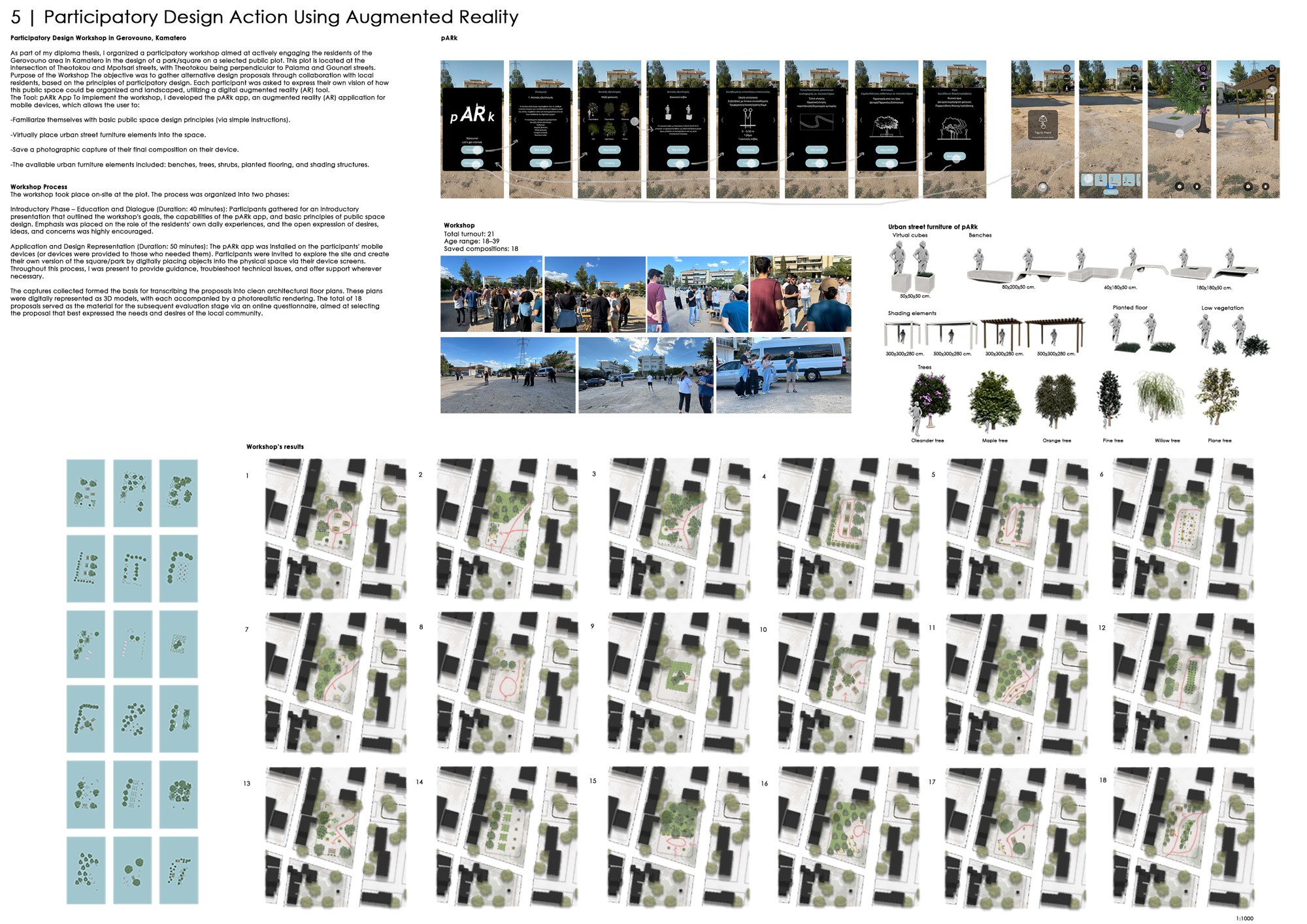
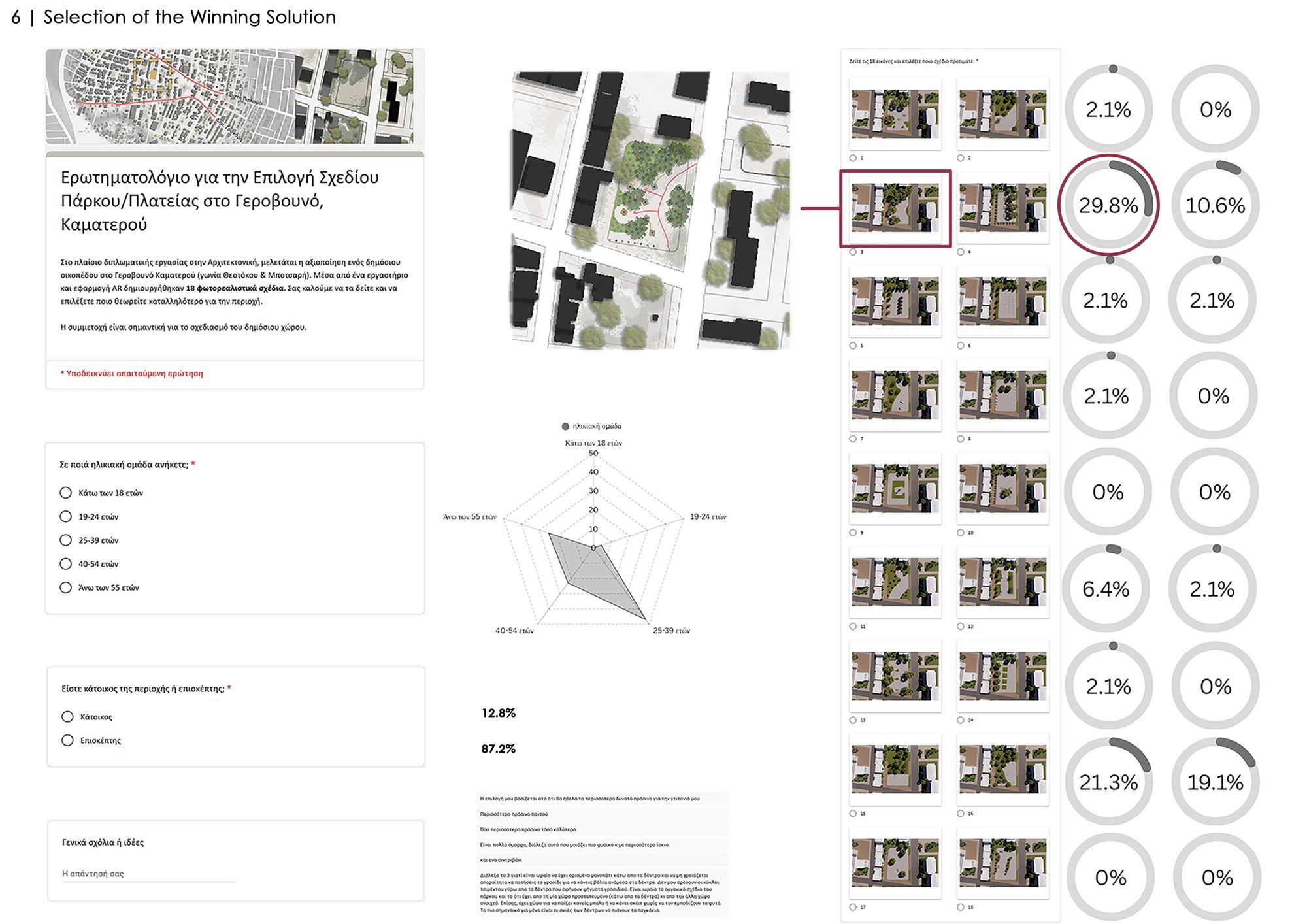
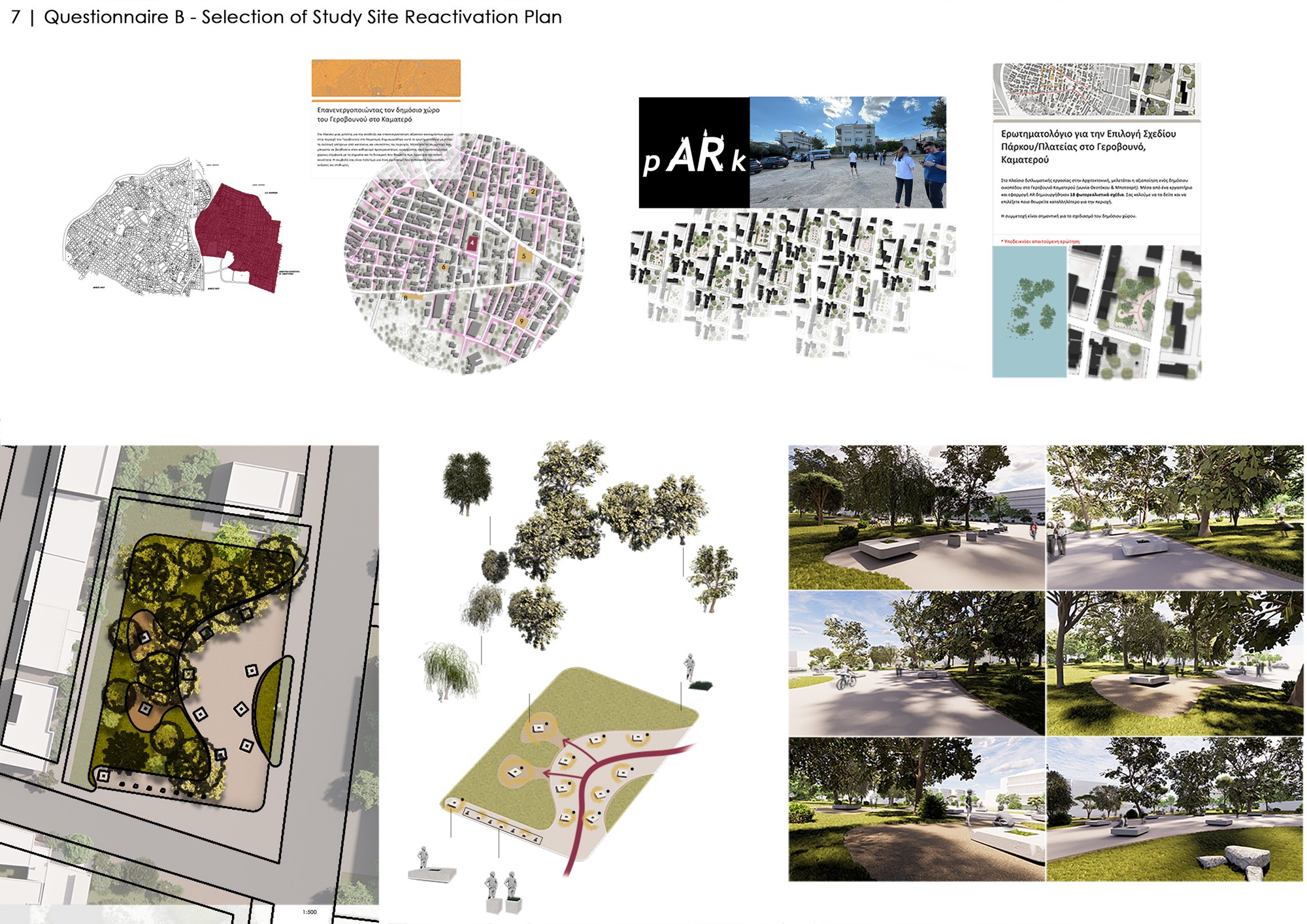
This research investigates how Augmented Reality (AR) can facilitate participatory urban planning by bridging the gap between professional expertise and community needs in the redesign of neglected public spaces, specifically focusing on the Gerovouno district of Kamatero in Athens. Moving away from traditional top-down planning, the methodology combined neighborhood spatial analysis and resident surveys with an on-site workshop featuring "pARk"—a custom AR application built with Unity and Blender based on Jan Gehl’s human-scale urbanism principles. Through this tool, 21 participants actively designed and visualized 18 different spatial proposals for an underutilized plot on Theotokou Street by placing and scaling elements like greenery, shading, and seating. Subsequent community evaluation revealed a strong preference for ecologically integrated designs, culminating in a winning concept (29.8% of votes) characterized by a central pathway, intersecting trails, planted pockets, and shaded rest areas. Ultimately, the study demonstrates that real-time AR visualization empowers non-experts to move beyond abstract discussions into active co-creation, offering a scalable framework for future urban regeneration initiatives.
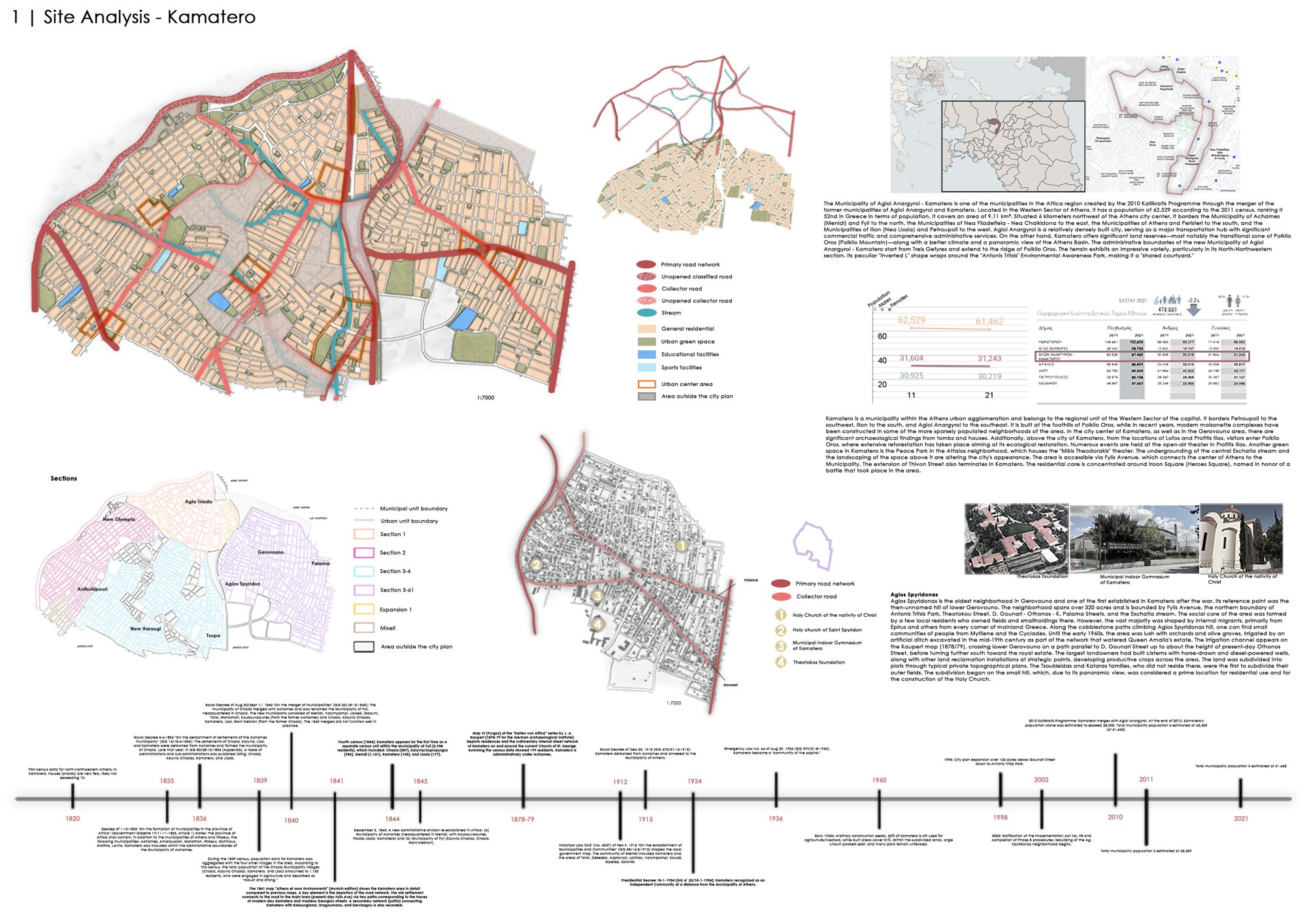
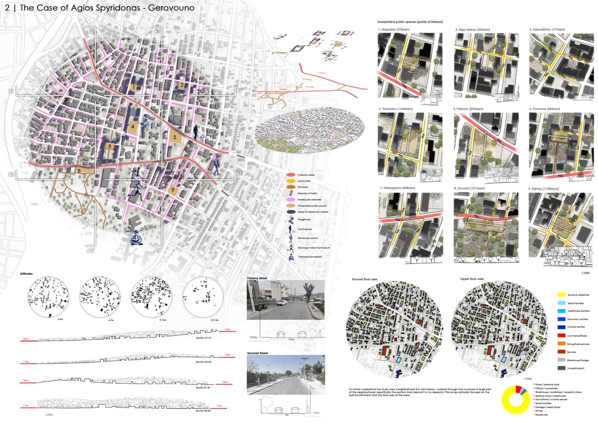
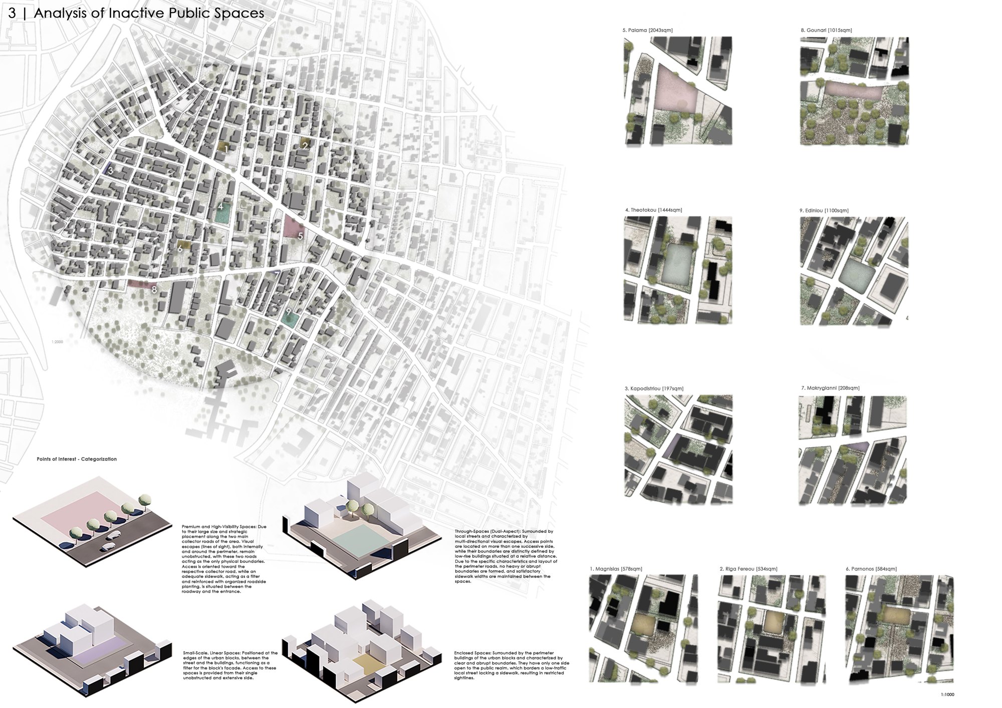
Diploma thesis – Maroulina Kyriakidou, Paraskevi Kampouri. Supervisor: Vasiliki Geropanta. Technical University of Crete, School of Architecture – November 2024
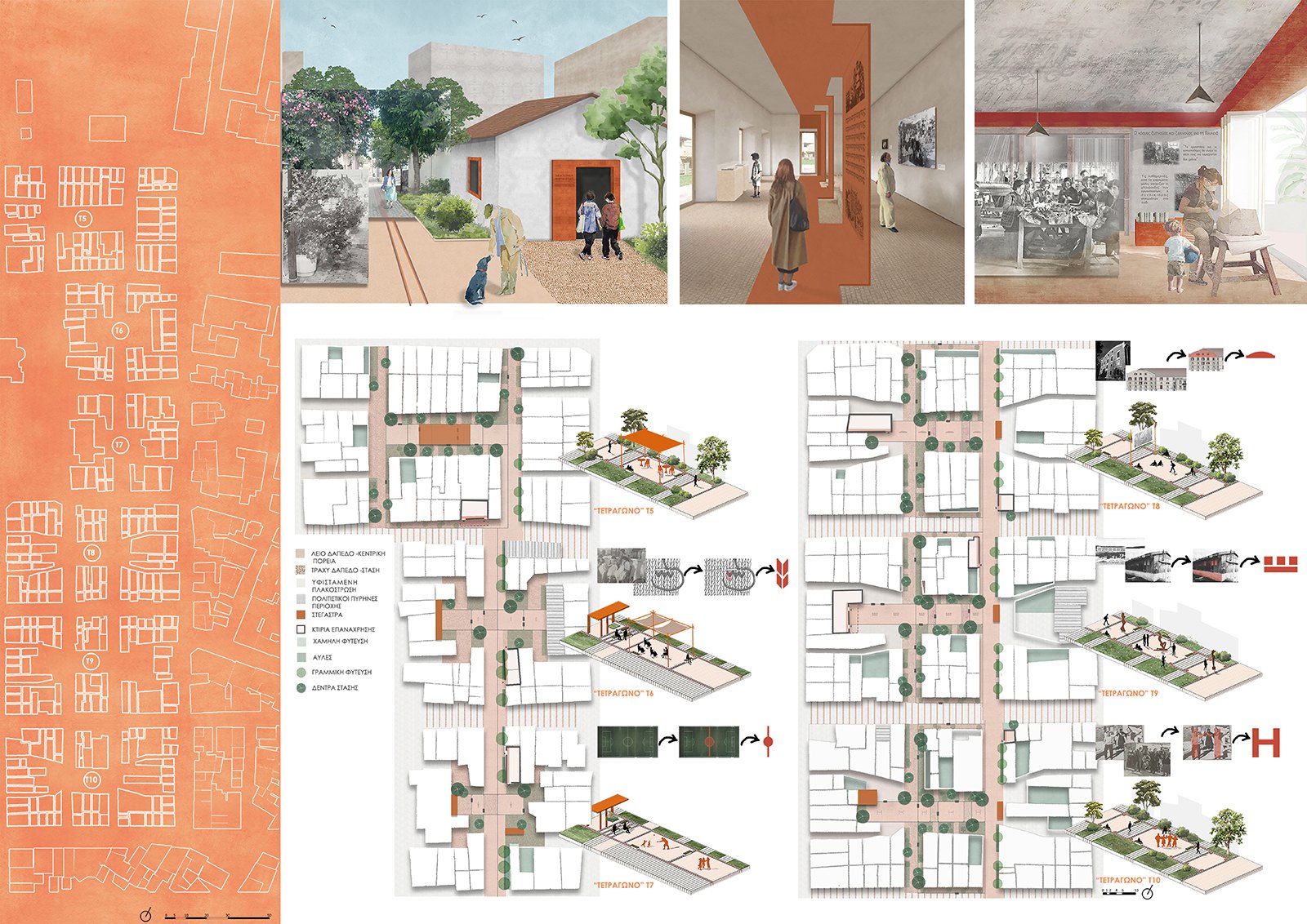
BE-COMMONING THROUGH MEMORY: Urban Transitions in the “Tetragona” of Nea Ionia, Magnesia
This thesis investigates the dialectical relationship between memory and urban space, examining how the lived experiences of residents jointly shape the identity of the city and the forms of collective life. The refugee settlement of Nea Ionia in Magnesia is selected as the field of study, where historical traces and the spirit of collectivity permeate the urban fabric from the settlement of the refugees to the present day.
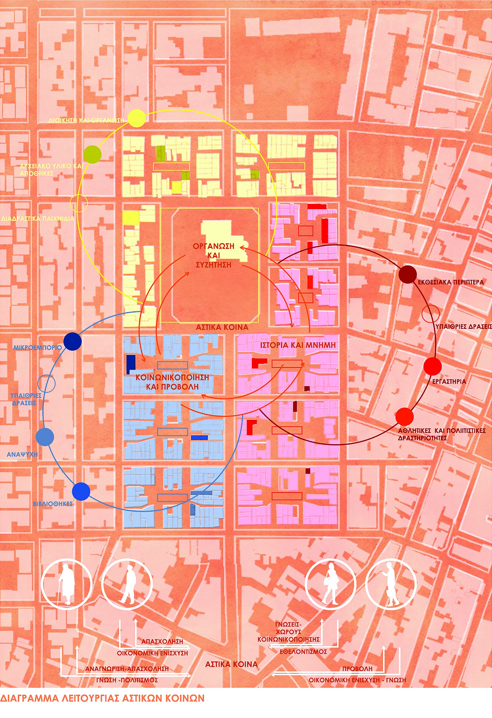
The design approach is based on the concept of “urban commons,” namely the process through which residents reconstruct relationships of collectivity through the shared use and management of urban space. Taking as a reference point the “Tetragona”, the historical center of the refugee settlement, the study seeks to highlight memories of lost collectivity and to explore their role in activating public space.
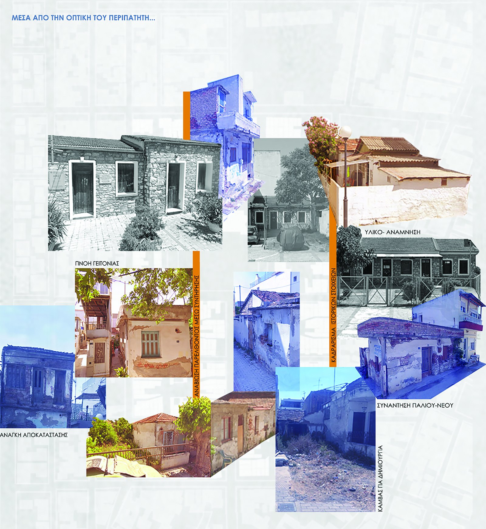
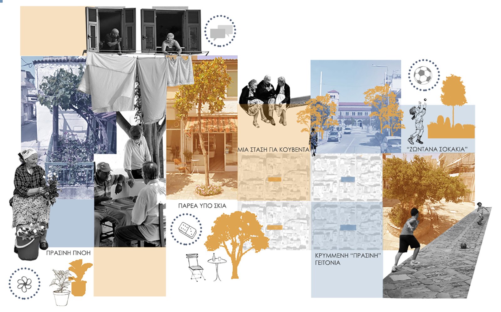
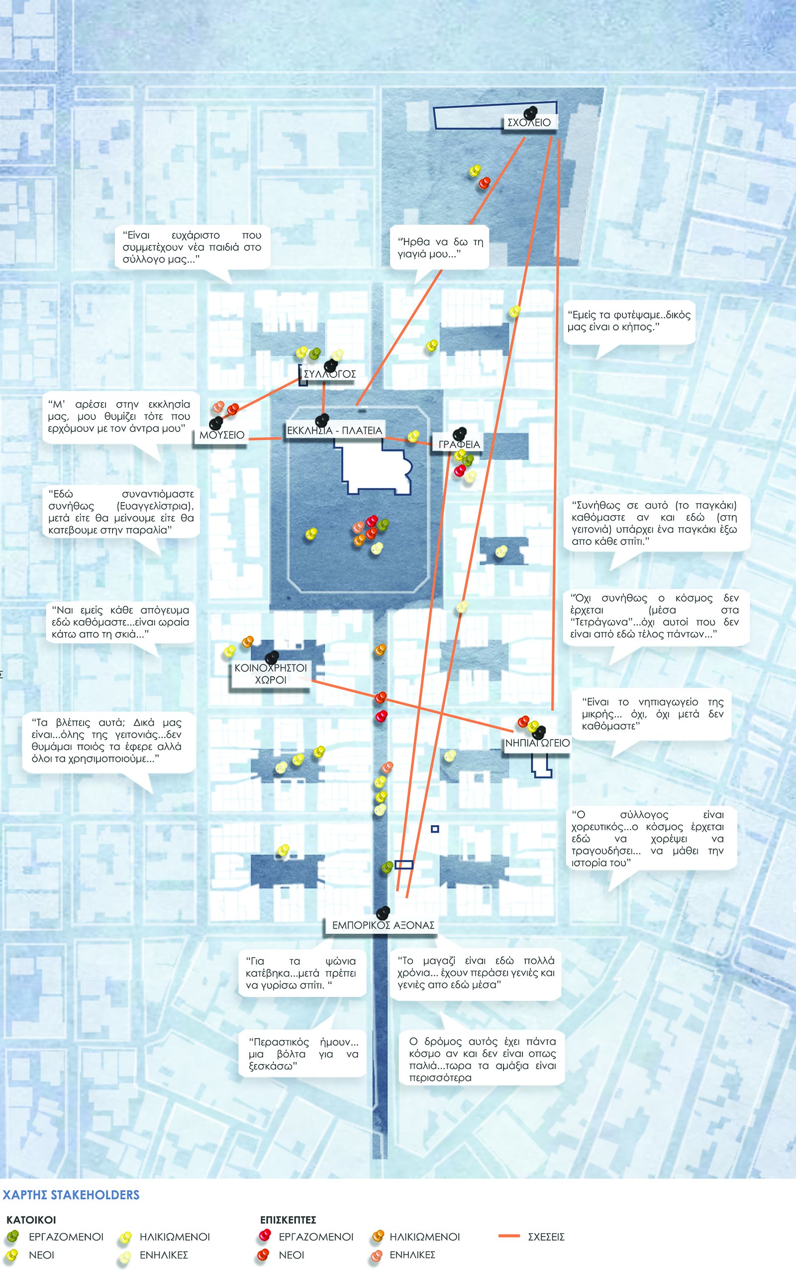
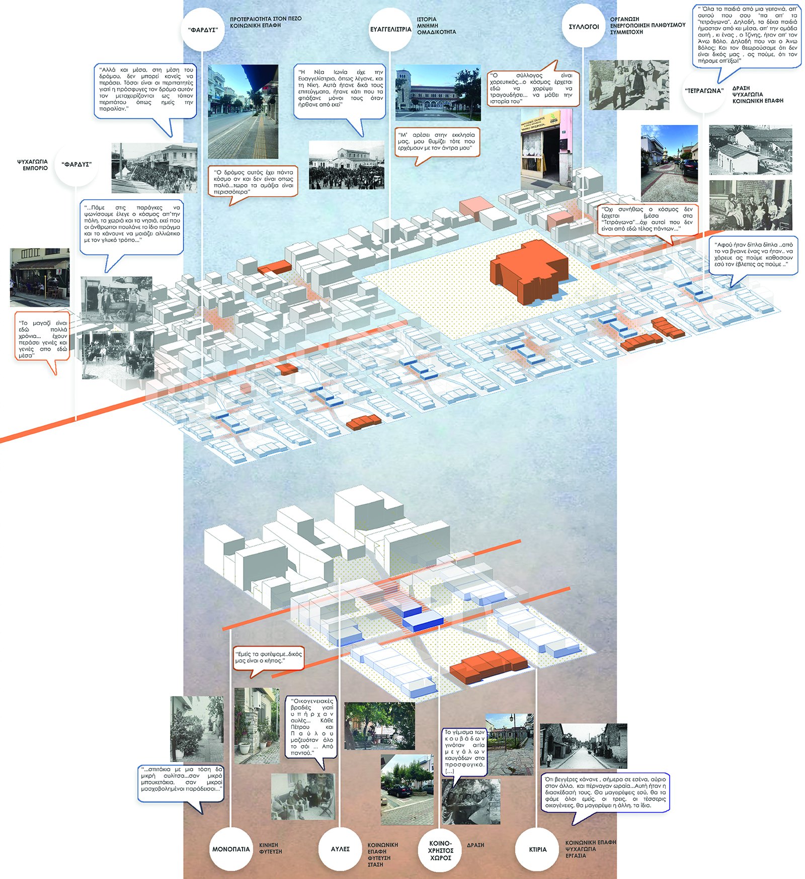
Through the documentation of spatial elements, memory narratives, and the everyday practices of residents, a network of tangible and intangible characteristics emerges, reinforcing the sense of neighborhood and creating vibrant spaces of interaction. Using the experience of the pedestrian moving through the city as a starting point, the study aims both to reveal elements that testify to the collectivity of the past and to reinterpret them in the present through the practice of urban commons.
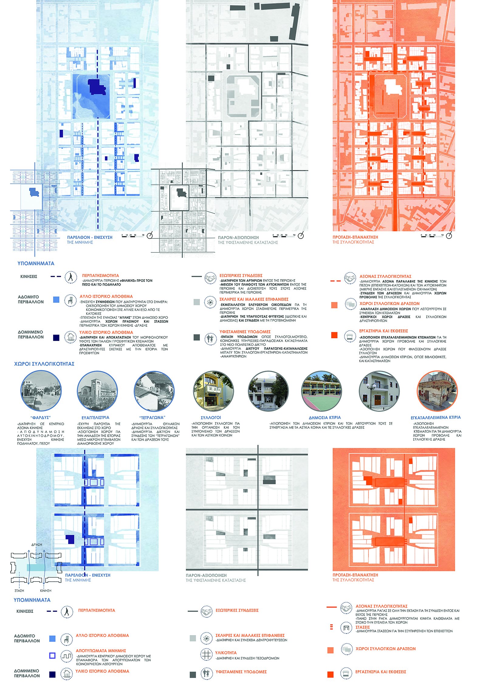
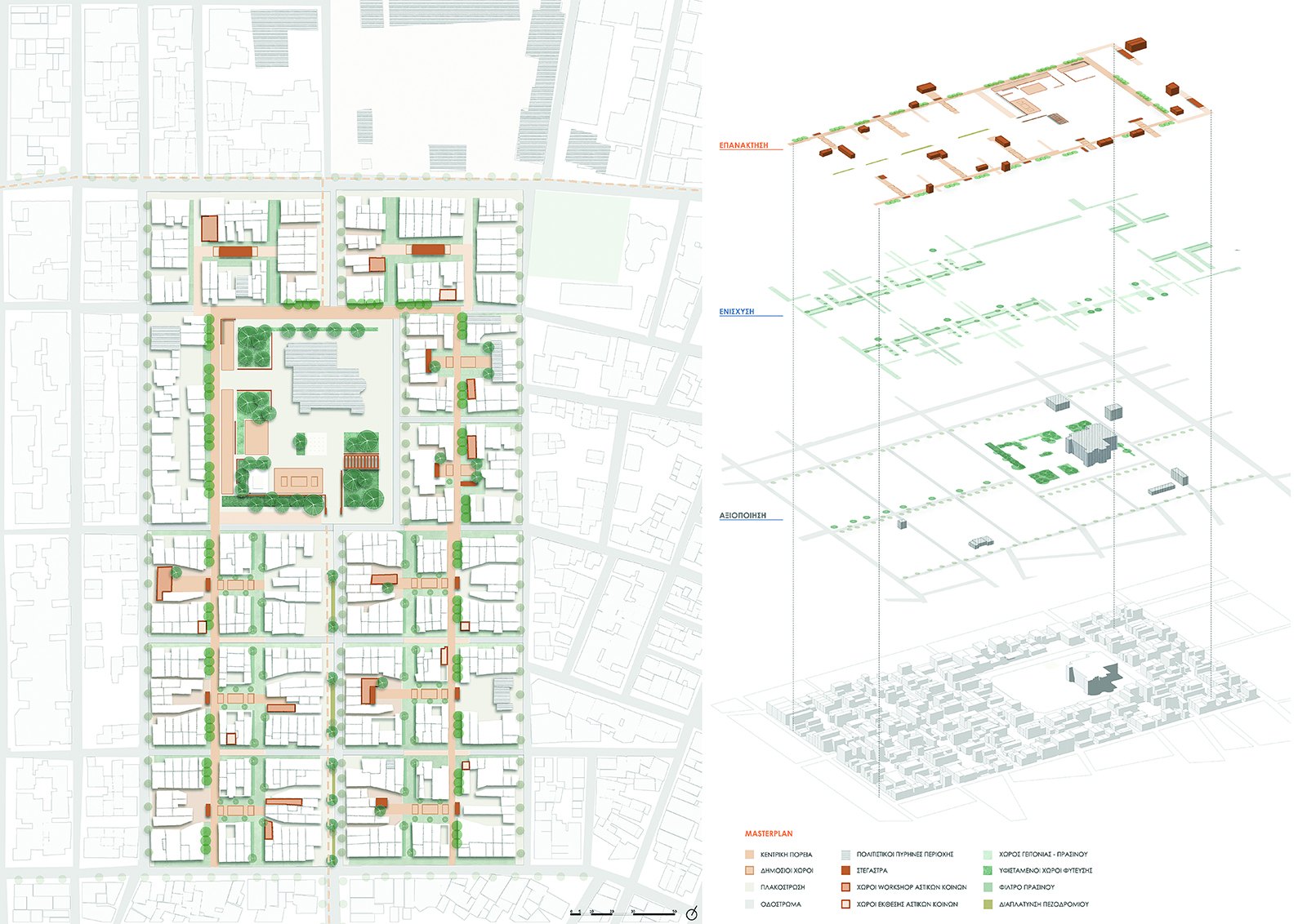
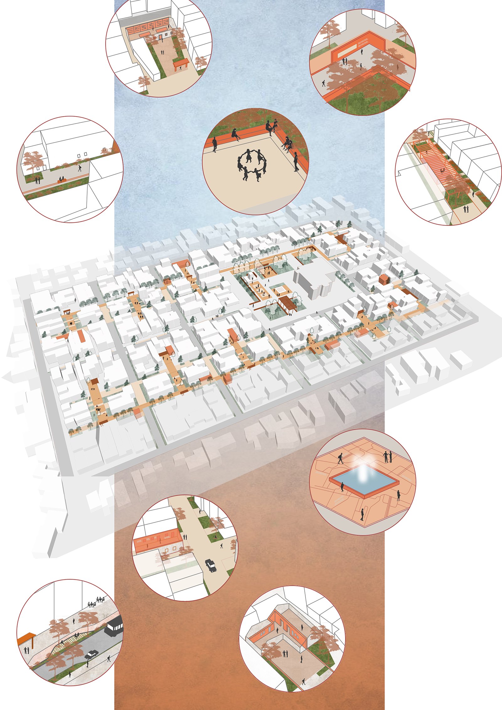
The design proposal focuses on the creation of a network of small-scale shared public spaces, making use of pathways, existing urban voids, and the built environment within the blocks. The objective is to strengthen collectivity and activate the memory of place through subtle interventions that connect the historical past with contemporary everyday life.
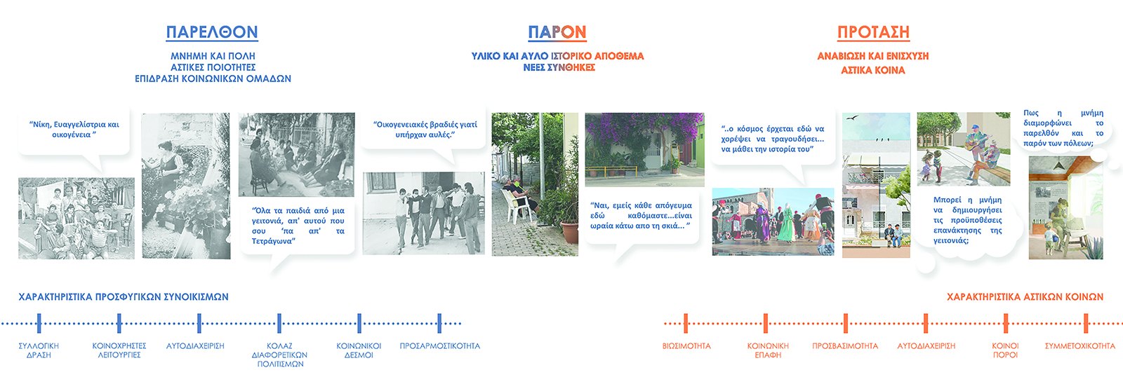
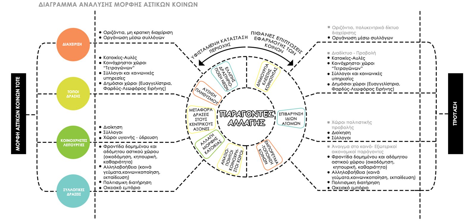
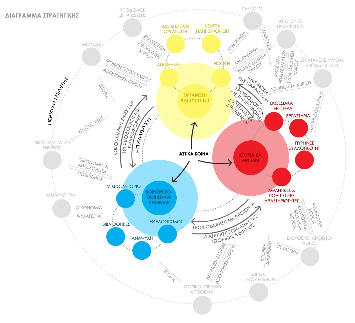
The strategy is articulated around three main axes: the past, where the material and immaterial elements of historical memory are highlighted; the present, where characteristics of urban space are utilized; and the proposal, where these dimensions are synthesized into a cohesive design strategy through new interventions and the practice of urban commons.
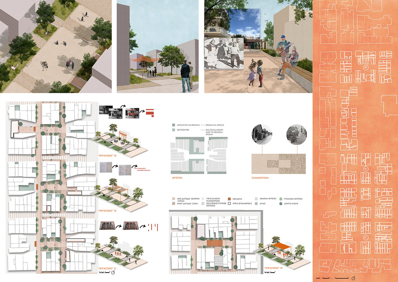
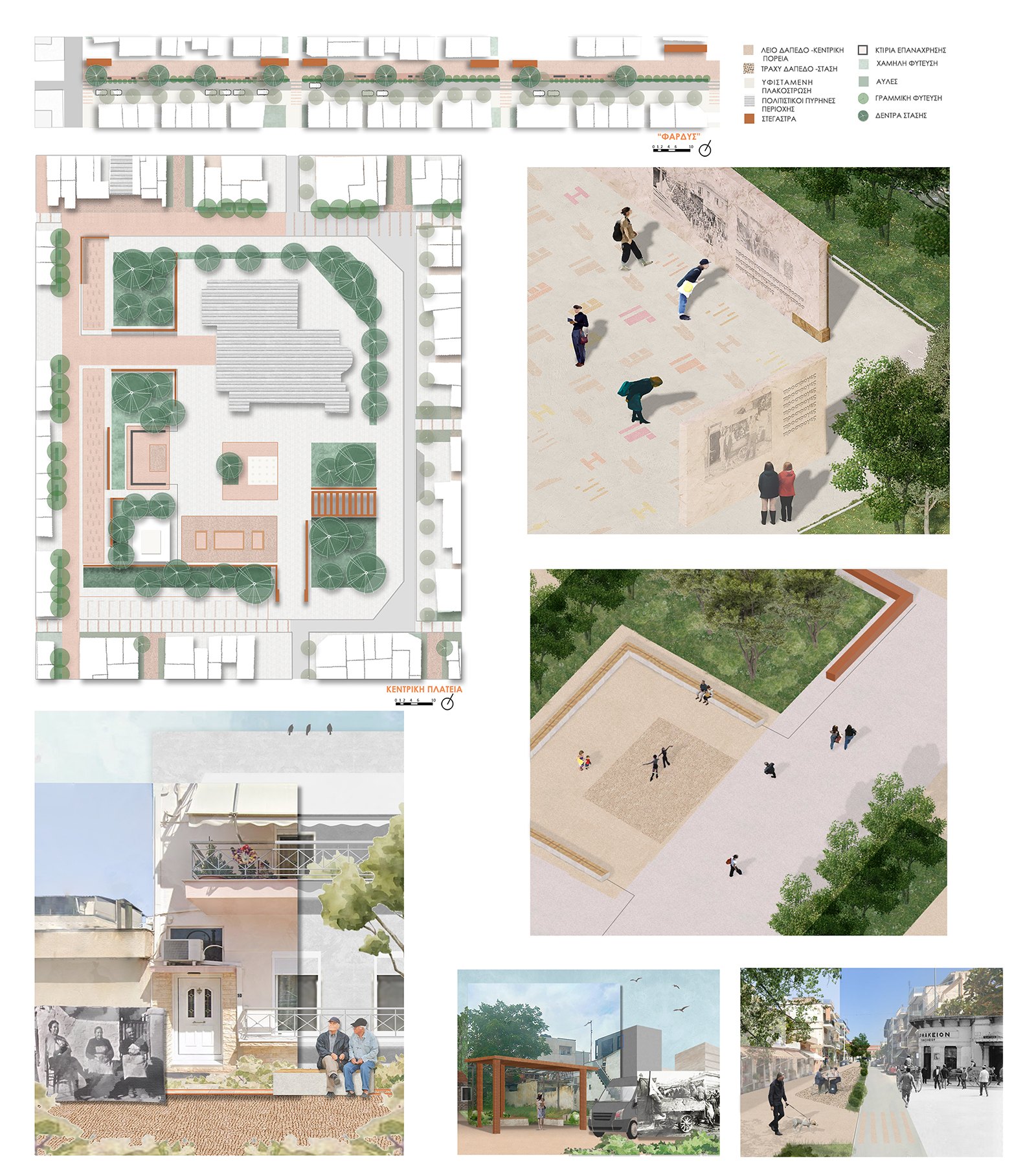
A central element of the proposal is the formation of a primary route connecting the squares of the area, functioning as an axis of social encounter. Along this route, a metal structure is incorporated—a symbolic “rail” that references the historical movements of the residents.
This structure extends into the interior of the squares and accommodates seating elements, forming a flexible, modular public space.
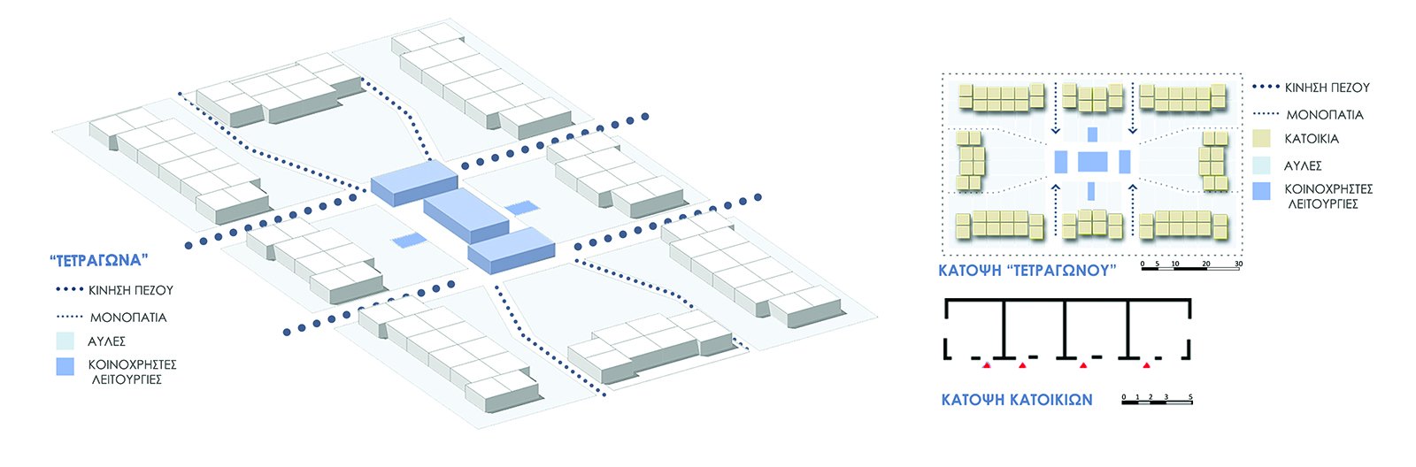
Drawing on the spatial imprint and functions of the past, each “Τetragono” is organized around a central public space that concentrates the main activities, framed by a peripheral green zone functioning both as a space of appropriation and as a protective boundary for the residences. At the same time, a secondary, softer route is developed, complementing the circulation network of the area.
The planting strategy and paving materials follow the main design logic. Along the central route and within the interior squares, trees are selected to reinforce spatial continuity and create shaded paths, combined with smooth paving that facilitates user movement. In contrast, the peripheral residential zones and the softer route feature low and dense planting acting as a filter between public and private space, while rough paving introduces symbolic references to collective memory and to the function of the squares as spaces of urban collectivity.
Finally, in collaboration with the existing associations of the study area, a network of shared spaces is created within abandoned and historic buildings. These are proposed to be reused for collective activities through subtle interventions employing materials and morphological elements corresponding to those of the public spaces, ensuring spatial and aesthetic continuity.
This strategy seeks to foreground memory as an active design tool, reestablishing the neighborhood as a space of collective experience and social interaction.
Projects developed by students – 2020
Projects developed by students – spring 2019
Digital Media III, undergraduate course, 4th semester
Instructors: Panos Parthenios, Anna Karagianni



Projects developed by students – spring 2017
Digital Media III, undergraduate course, 4th semester
Instructors: Panos Parthenios, Alexandros Peteinarelis


Projects developed by students – spring 2016
Digital Media III, undergraduate course, 4th semester
Instructors: Panos Parthenios, Anna Karagianni


Projects developed by students – spring 2015
Digital Media III, undergraduate course, 4th semester
Instructors: Panos Parthenios, Anna Karagianni


Projects developed by students – spring 2014
Digital Media III, undergraduate course, 4th semester
Instructors: Panos Parthenios, Anna Karagianni